Our Services
Comprehensive civil engineering solutions for all your development needs
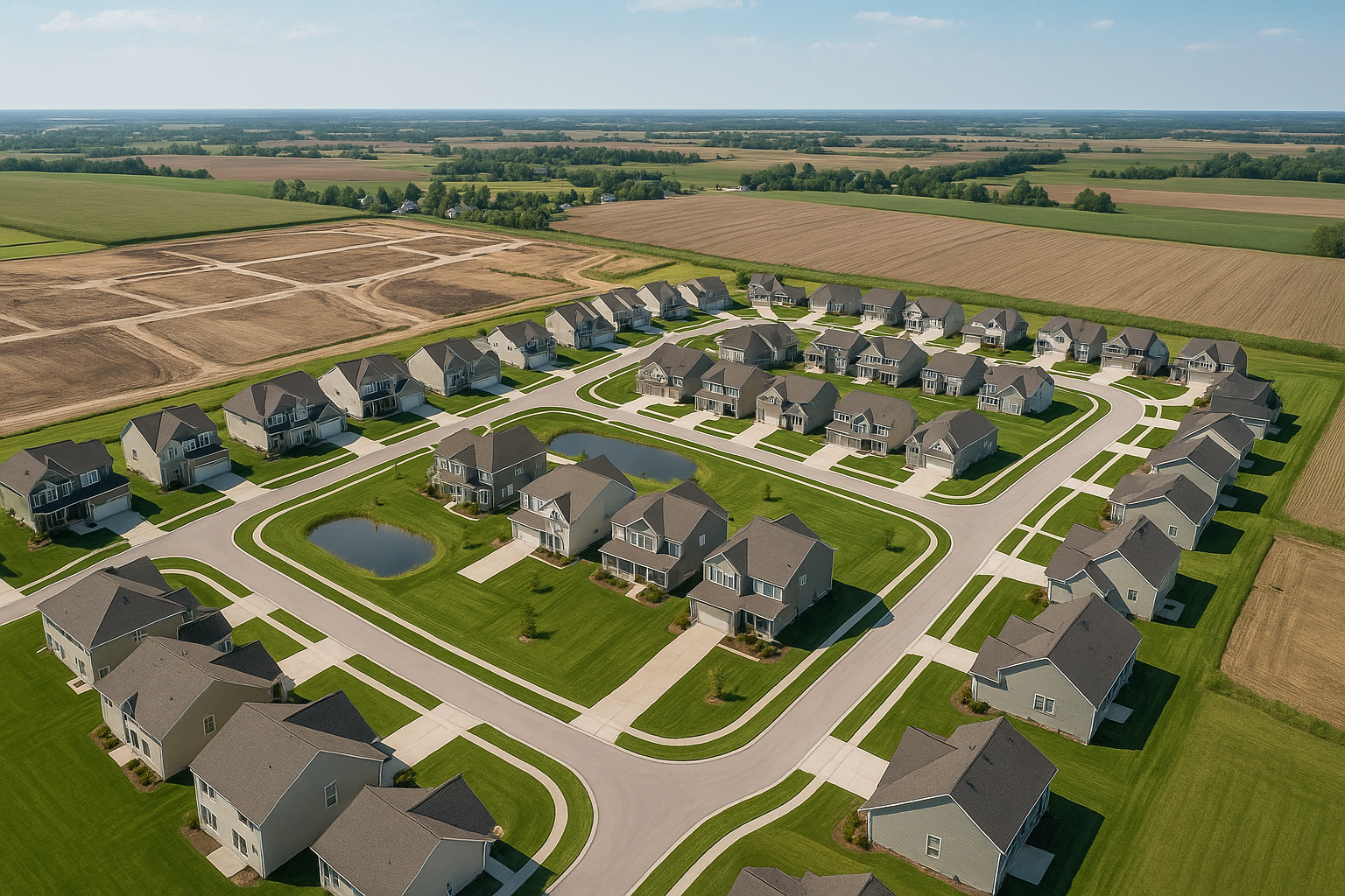
Civil Engineering
Comprehensive engineering solutions for development projects


Engineering Studies
IDE is capable of creating preliminary engineering studies, including feasibility analyses, to determine the proper course of action for developers, municipalities, and governmental agencies. This includes assessment documentation, public meetings, master planning, overall city planning services, and future planning requirements.
Drainage Studies and Plans
IDE provides drainage design and watershed analysis for a wide range of projects. IDE provides both above-ground and below-ground detention design, orifice design, sustainable stormwater design, permeable pavements, etc. Long term development plans and watershed analysis studies are done frequently in our office and we understand the need for controlling stormwater as development increases.
Zoning & Building Compliance
IDE is capable of providing assistance in acquiring variances and zoning approvals at all stages of development. This includes pursuing zoning changes, Planned Unit districts, compliance with zoning standards, and meeting with officials to help clients solve zoning issues.
Sustainable Design/LEED Certification
With a LEED AP on staff with experience on several LEED projects, IDE is able to offer Civil Engineering design that incorporates Sustainable Design options for a more efficient development. This includes bioretention basins, vegetated filters, and other stormwater solutions. IDE also offers certification services for any project interested in pursuing LEED.
Site Development
IDE has been providing and will continue to provide excellent Site Planning deliverables. This involves the design of pavement, on-site utilities, parking, access, sidewalks, drainage, stormwater detention, ADA ramps, crosswalks, bus drives, fire hydrant layout, demolition plans, paving striping, heavy duty pavements, erosion control plans and permits, etc. IDE's site plans conform to the company's standard operating procedures and QA/QC requirements.
Utility Extensions
IDE can create Plans and Profiles for public utility extensions of sewer and water services throughout southwestern Ohio and northern Kentucky. This involves the creation of construction documents as well as EPA permit documents and coordination with local utility agencies and state reviewing agencies. IDE provides start-to-finish support for utility extensions of all lengths.
Permit Acquisition
On all projects, IDE is fully capable of acquiring permits on a local, municipal, county, state, or federal level. This is applies to utility extensions, street modifications, stream modification, site development greater than one acre, etc. IDE works with FEMA, soil and water divisions of state departments, federal stream degradation requirements, and other entities to ensure the development is legal and approved on all levels.
Technical Specifications
IDE provides technical specifications for all applicable projects in MasterSpec 2018 format, and handles specifications from an environmental standpoint on typical civil engineering projects to specialized demolition work. IDE provides conformed specifications during the bidding process and carefully tracks changes and updates for future projects.
Construction Cost Estimates
IDE will provide a professional opinion of Construction Cost for projects at two separate occasions during a project. This service includes Value Engineering, which can save developers and municipalities a great deal of money during the plan development stage of a project.
Construction Management/Grant Funding
IDE can provide start-to-finish construction management services, including bid submittal creation, bid review, and Change Order review. Also, IDE is fully versed in Grant Funding and can handle all reporting requirements throughout the construction process. Assessment documentation and administrative advising on a civil level is included in these services.
Land Planning
Comprehensive land planning and resource management
Land planning is a comprehensive process that includes preliminary analysis, schematic design and management of natural land resources to meet specific goals. IDE is an expert with involving collaboration with stakeholders like developers, architects, government agencies and community members, to balance the competing demands for different land uses. IDE seeks to achieve a desirable social and environmental outcomes that includes conservation and benefits community development.
We strive to develop planning strategies that balance economic value to our clients and respect the local context of the project area while providing flexible options to accommodate potential market changes. Our goal is to provide sustainable and innovative spaces that provide a higher quality of life for the intended users.
Land Surveying
Professional surveying services with state-of-the-art technology
IDE provides a team of survey personnel that have worked closely with government agencies in providing cost effective projects. IDE uses AutoCAD Civil 3D software to generate plans and profiles, as well as project plan documents.
IDE is committed to value engineering and will design projects to minimize cost where feasible. Clients can feel confident that IDE's team will complete projects within the stipulated time frame and with the expertise necessary to deliver services in an efficient, cost effective and technically innovative, sound manner.
Boundary Surveys
IDE's Professional Surveyors can mobilize three separate survey crews at any given time. All members of the Surveying Services group are proficient in document research. During the research phase of any boundary survey, IDE's staff will visit the county Auditor's/Clerk's Office and obtain the names of property owners as well as all adjoining property owners. Tax maps are acquired for field reference and to assist in boundary resolution. Copies of deeds, plats of survey and subdivision plats are obtained from the county Recorder's Office. If the property is located on a state or federal highway, copies of highway drawings are requested from the state's Department of Transportation.
ALTA Surveys
IDE routinely creates ALTA/ACSM Land Title Surveys (a.k.a. ALTA Surveys) for a variety of clients, title insurance agencies and lending institutions. IDE's staff is very familiar with the minimum standards for such surveys as adopted by the American Land Title Association and the American Congress on Surveying and Mapping.
To perform these surveys, IDE uses state-of-the-art robotic total stations and data collection systems to acquire the necessary locations. This field-collected data is combined with easement locations taken from the title policy, the zoning classification of the property and flood plain information obtained from the Flood Insurance Rate Maps issued by FEMA, and drafted into a comprehensive drawing.
The boundary line of the subject property will also be shown on the ALTA drawing and will be based upon a survey that meets or exceeds the state's minimum standards for boundary surveys.
Topographic Surveys
IDE uses state-of-the-art GPS, total stations, and data collection systems to collect topographic data in an electronic format. Field located utility structures and appurtenances are cross-referenced with available utility records. This field-collected data is loaded directly into AutoCAD Civil 3D software where maps are compiled.
Construction Staking
IDE uses a system for construction layout that is truly unique in today's industry. Electronic staking plans complete with coordinates and elevations are made for the computer version of the construction drawings and then uploaded into a data control module (basically a hand held computer). If a data control module is used, typically it is connected to the total station. IDE uses a completely robotic total station. Instead of the control module being connected directly to the total station, it is connected via telemetry. A two-way radio built into the side of the robotic total station communicates with a two-way radio connected to the data control module. The total station is then controlled from the data control module. This procedure allows both members of the survey crew to work together, away from the instrument. Once the stake is in the ground, a second shot is taken providing a grade to the proposed elevation. Each point is visited only once.
This system improves the crew's production by 25-30%. Over the course of a typical construction project, this amounts to a sizable cost and time savings.

Environmental Consulting
Comprehensive environmental assessment and consulting services
Environmental Assessments
One of the key aspects of due diligence for property transfer and site development projects is the Phase I Environmental Site Assessment (Phase I ESA). IDE, Inc. has been conducting Phase I ESAs according to current ASTM Guidelines in Ohio, Kentucky and Indiana for over 35 years for developers, lenders, real estate agencies, lawyers and property owners. With a staff of licensed professionals, IDE can address the growing array of environmental concerns facing the challenges of development and re-development.
Environmental Compliance Audits/Permits/Training
IDE provides compliance auditing to assist facility managers when evaluating the status of environmental compliance and the effectiveness of environmental management systems. IDE will provide a compliance audit report that is independent, confidential and objective. The scope of the audit addresses the level and quality of environmental activities and risks at the facility over the most recent 12-month period.
After the environmental audit, IDE can assist with solving any non-compliance issues including permitting, testing, and development of training programs. IDE's personnel have developed and implemented OSHA and RCRA training programs for both manufacturing plant employees and environmental managers.
Remedial Design
IDE's approach to Remedial Action Plans and Designs is based on the potential risk posed by the environmental condition(s) and the most complete and sound scientific data a given project will warrant. IDE designs plans for remedial action that consider cost and time restraints, potential for innovative application of technologies, and all available regional and site specific data to address the end goals of the stakeholders for any particular project.
Risk Assessment
IDE's approach to environmental assessment and remediation uses risk assessment as an integral part of the process from start to finish. By factoring in the risks of exposure to the public and the environment from environmental threats, site assessments and remedial strategies are tailored to identify the source areas and protect the most sensitive potential receptors. This targeted approach results in considerable time and cost savings for our clients. IDE's team of experienced risk assessors uses the latest programs and technologies to accurately define risk and keep each project moving toward a successful completion.